
Filter - control incident types displayed on map.
Zoom to your location
Reset map zoom and position
Show Legend
Unit Information
Colorado
Meeker,
Colorado
81641
Agency Name: Bureau of Land Management

Agency Abbreviation
BLM
Colorado
Meeker,
Colorado
81641
Agency Name: Bureau of Land Management
Agency Abbreviation
BLM
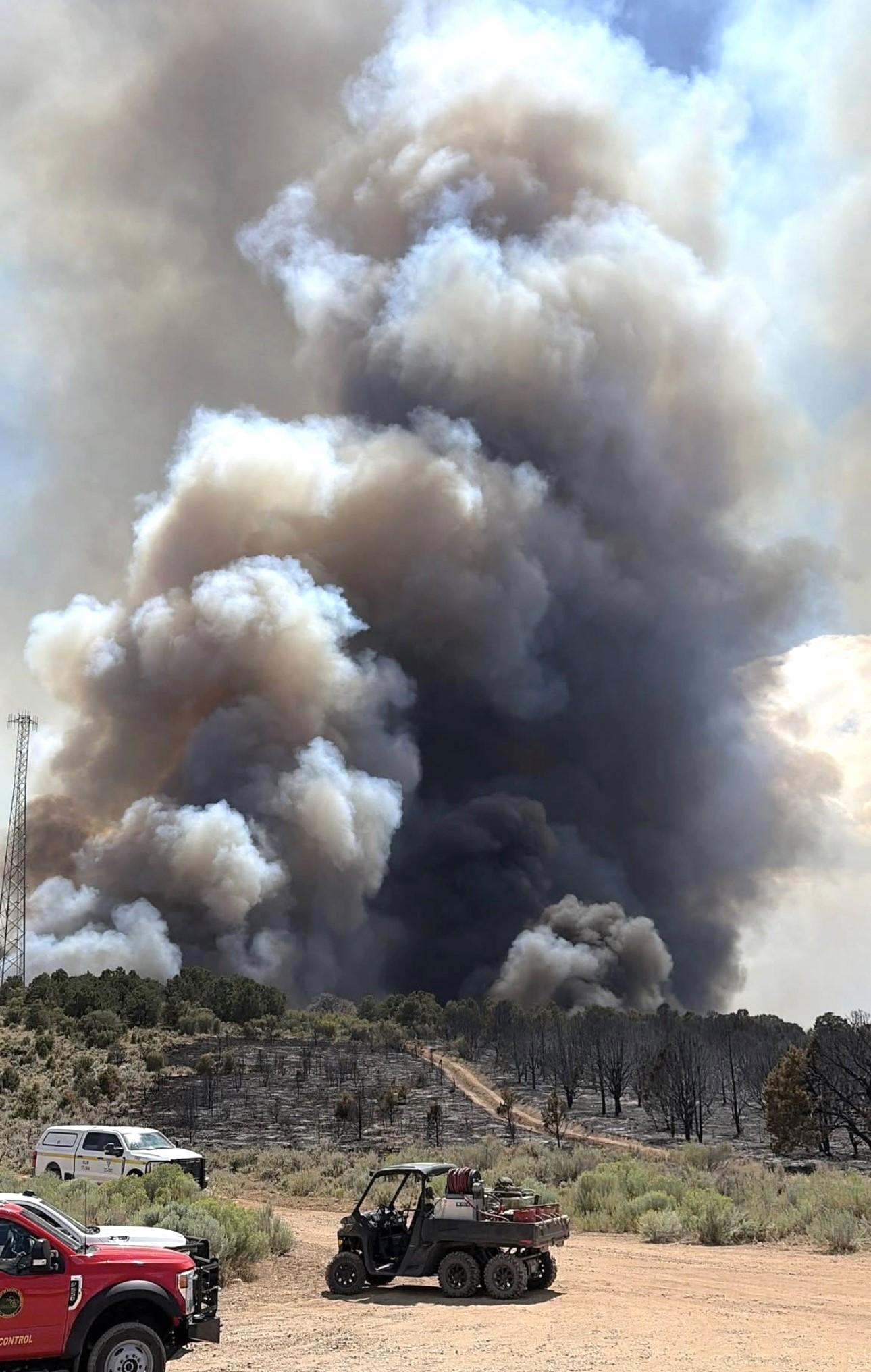
The PL Gulch Fire was reported at 12:30 p.m. on July 13, 2026, in the County Road 76 and County Road 5 area of Rio Blanco County. The fire was burning in brush, grass, and Piñon/Juniper mix, approximately 20 miles southwest of Meeker.
Rio Blanco Fire Protection District and the Bureau of Land Management (BLM) responded to the scene. Initial attack efforts included ground personnel and aerial resources.
The Colorado Type 3 Incident Management Team (Team CO) assumed management of the fire at 6:00 a.m. on July 17. The Team is working closely with local and regional resources, who remain actively engaged in suppression efforts. The fire is burning on BLM land and did not initially threaten any structures. As the fire moved south toward County Road 5, one residence was evacuated.
As of July 20, there are no evacuation orders and all roads are open. There was minor damage to high-voltage transmission lines. Cooperators are working on repairs.
| Current as of | Mon, 07/20/2026 - 15:58 |
|---|---|
| Incident Time Zone | Mountain Standard Time |
| Incident Type | Wildfire |
| Cause | Human Caused |
| Date of Origin | |
| Incident Time Zone | Mountain Standard Time |
| Location | 20 miles southwest of Meeker, BLM White River Field Office, Rio Blanco County |
| Incident Commander | Phil Daniels, Incident Commander Team Colorado |
| Incident Description | The PL Gulch wildfire is burning in grass, brush, and Piñon/Juniper mix, approximately 20 miles southwest of Meeker. |
| Coordinates |
39° 52' 42'' Latitude
-108° 13' 41 '' Longitude |
| Total Personnel: | 235 |
|---|---|
| Size | 1,580 Acres |
| Percent of Perimeter Contained | 55% |
| Estimated Containment Date | 7/23/26 |
| Fuels Involved | Piñon‑juniper, sagebrush, and grass |
| Planned Actions |
Fire managers have established key operational objectives to keep the fire north and east of Rio Blanco County Road 5, south of County Road 76, and west of County Road 3. Oil and gas infrastructure and nearby residences remain priority values at risk and crews are actively working to reduce the threat to these areas. |
|---|---|
| Projected Incident Activity |
Thanks to the continued hard work from firefighters, containment on the fire is now at 55%. Crews in Division Z and Division D were able to complete the direct handline on the western edge of the fire, ensuring a handline around the entire fire perimeter. These crews also began installing hose lines along the break to help with mop-up. Sunday morning, a National Infrared Operations (NIROPS) flight identified multiple small spot fires around the fire perimeter. Firefighters were able to locate and/or install handlines around each location. Despite Sunday’s heavy rains in Meeker and the surrounding area, minimal rain fell on the fire. Current Situation: The fire is burning in grass, brush, and pinon/juniper mix.
|
| Weather Concerns | Weather: High temperatures (mid 80s-low 90s) to the fire area. Winds are forecasted to be from the west in the afternoon at 5-10 mph, with humidity ranging from 17-22%. Fire Behavior: Fuels are drought-stressed and very dry. Increased fire activity has been common when wind and terrain align. Concerns remain high if afternoon thunderstorms materialize, producing gusty outflow winds. |
|---|